
- Start >
- Rivers >
- Waterlevel >
- Untere Donau >
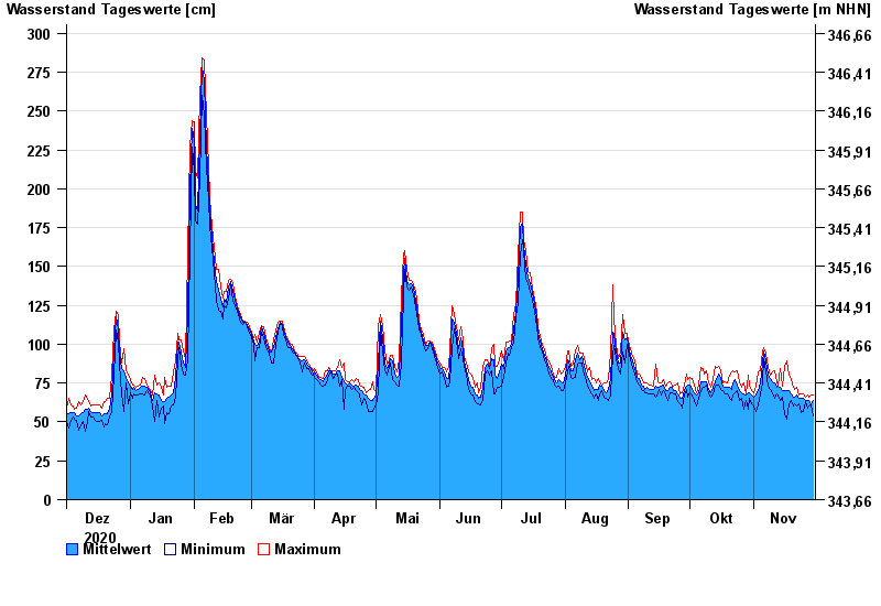
- Münchshofen >
- Chart of year

Chart of year Münchshofen / Naab
Waterlevel from 01.12.2020 to 30.11.2021
- 15.01.2011 Wasserstand: 396 cm
- 27.03.1988 Wasserstand: 387 cm
- 27.01.1995 Wasserstand: 385 cm
- 04.01.2003 Wasserstand: 381 cm
- 24.02.1970 Wasserstand: 363 cm
| Date | Mean value [cm] | Maximum [cm] | Minimum [cm] |
|---|---|---|---|
| 30.11.2021 | 64 | 67 | 54 |
| 29.11.2021 | 62 | 67 | 61 |
| 28.11.2021 | 64 | 66 | 60 |
| 27.11.2021 | 64 | 67 | 59 |
| 26.11.2021 | 64 | 66 | 63 |
| 25.11.2021 | 65 | 68 | 57 |
| 24.11.2021 | 65 | 68 | 56 |
© Bayerisches Landesamt für Umwelt 2024