
- Start >
- Rivers >
- Waterlevel >
- Untere Donau >
- Mühldorf >
- Chart of year

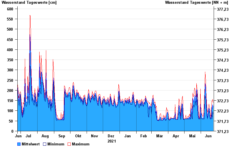
Chart of year Mühldorf / Inn
Waterlevel from 25.06.2021 to 24.06.2022
- 24.08.2005 Wasserstand: 799 cm
- 07.08.1985 Wasserstand: 766 cm
- 03.06.2013 Wasserstand: 708 cm
- 20.07.1981 Wasserstand: 677 cm
- 22.05.1999 Wasserstand: 662 cm
| Date | Mean value [cm] | Maximum [cm] | Minimum [cm] |
|---|---|---|---|
| 24.06.2022 | 117 | 141 | 83 |
| 23.06.2022 | 130 | 156 | 96 |
| 22.06.2022 | 109 | 146 | 61 |
| 21.06.2022 | 118 | 148 | 88 |
| 20.06.2022 | 68 | 94 | 59 |
| 19.06.2022 | 61 | 67 | 59 |
| 18.06.2022 | 71 | 98 | 60 |
© Bayerisches Landesamt für Umwelt 2024