
- Start >
- Rivers >
- Waterlevel >
- Untere Donau >
- Mühldorf >
- Chart of year

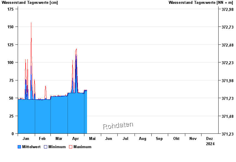
Chart of year Mühldorf / Inn
Waterlevel from 01.01.2024 to 31.12.2024
- 24.08.2005 Wasserstand: 799 cm
- 07.08.1985 Wasserstand: 766 cm
- 03.06.2013 Wasserstand: 708 cm
- 20.07.1981 Wasserstand: 677 cm
- 22.05.1999 Wasserstand: 662 cm
| Date | Mean value [cm] | Maximum [cm] | Minimum [cm] |
|---|---|---|---|
| 05.06.2024 | 285 | 290 | 281 |
| 04.06.2024 | 426 | 536 | 288 |
| 03.06.2024 | 296 | 475 | 202 |
| 02.06.2024 | 262 | 337 | 208 |
| 01.06.2024 | 320 | 390 | 268 |
| 31.05.2024 | 231 | 292 | 175 |
| 30.05.2024 | 150 | 183 | 123 |
© Bayerisches Landesamt für Umwelt 2024