
- Start >
- Rivers >
- Waterlevel >
- Untere Donau >
- Marienthal >
- Chart of month

Chart of month Marienthal / Regen
Waterlevel from 01.02.2021 to 28.02.2021
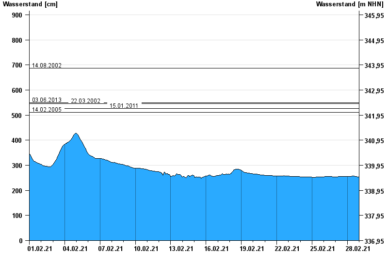
- 14.08.2002 Wasserstand: 687 cm
- 03.06.2013 Wasserstand: 550 cm
- 22.03.2002 Wasserstand: 545 cm
- 15.01.2011 Wasserstand: 526 cm
- 14.02.2005 Wasserstand: 511 cm
| Date | Waterlevel [cm] |
|---|---|
| 28.02.2021 23:45 | 253 |
| 28.02.2021 23:30 | 253 |
| 28.02.2021 23:15 | 253 |
| 28.02.2021 23:00 | 253 |
| 28.02.2021 22:45 | 253 |
| 28.02.2021 22:30 | 253 |
| 28.02.2021 22:15 | 253 |
© Bayerisches Landesamt für Umwelt 2024