
- Start >
- Rivers >
- Waterlevel >
- Untere Donau >
- Lohmannmühle >
- Chart of month

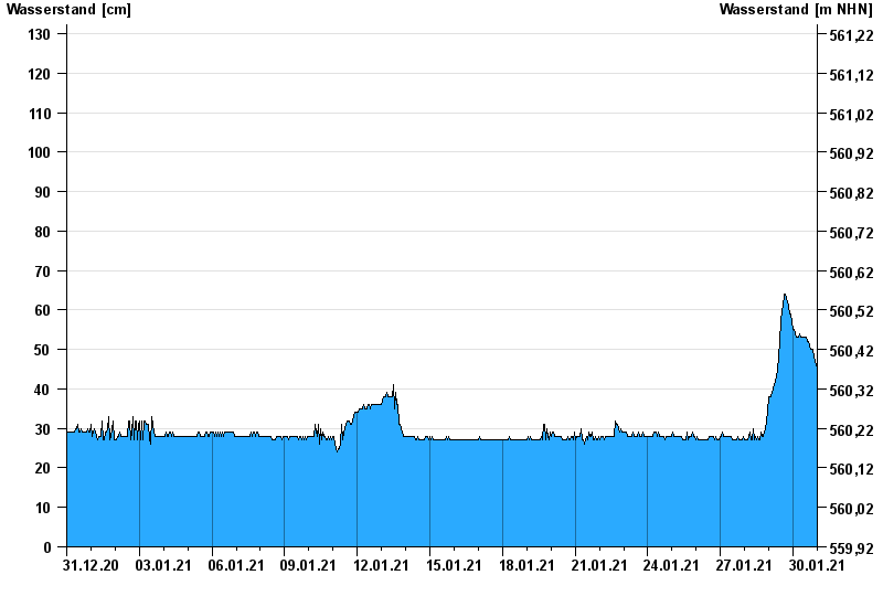
Chart of month Lohmannmühle / Kleiner Regen
Waterlevel from 31.12.2020 to 30.01.2021
- 26.01.1977 Wasserstand: 182 cm
- 13.08.2002 Wasserstand: 178 cm
- 23.12.1967 Wasserstand: 173 cm
- 22.07.1980 Wasserstand: 159 cm
- 28.05.2006 Wasserstand: 152 cm
| Date | Waterlevel [cm] |
|---|---|
| 30.01.2021 23:45 | 45 |
| 30.01.2021 23:30 | 45 |
| 30.01.2021 23:15 | 45 |
| 30.01.2021 23:00 | 46 |
| 30.01.2021 22:45 | 46 |
| 30.01.2021 22:30 | 46 |
| 30.01.2021 22:15 | 47 |
© Bayerisches Landesamt für Umwelt 2024