
- Start >
- Rivers >
- Waterlevel >
- Untere Donau >
- Landshut Flutmulde >
- Chart of year

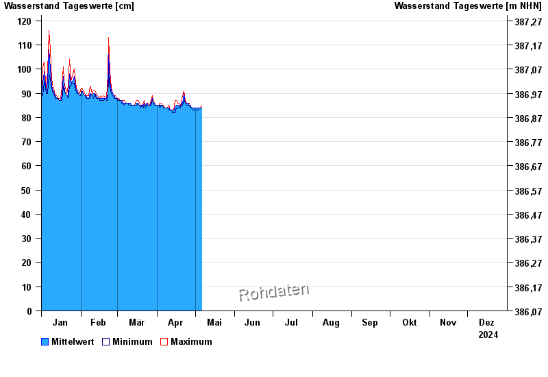
Chart of year Landshut Flutmulde / Isar
Waterlevel from 01.01.2024 to 31.12.2024
 Für diesen Pegel sind keine Hochwassermarken hinterlegt.
| Date | Mean value [cm] | Maximum [cm] | Minimum [cm] |
|---|---|---|---|
| 09.06.2024 | 103 | 103 | 102 |
| 08.06.2024 | 105 | 107 | 103 |
| 07.06.2024 | 114 | 126 | 107 |
| 06.06.2024 | 175 | 230 | 127 |
| 05.06.2024 | 271 | 295 | 231 |
| 04.06.2024 | 269 | 295 | 253 |
| 03.06.2024 | 232 | 252 | 223 |
© Bayerisches Landesamt für Umwelt 2024