
- Start >
- Rivers >
- Waterlevel >
- Untere Donau >
- Landshut Birket >
- Chart of year

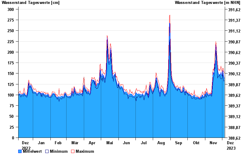
Chart of year Landshut Birket / Isar
Waterlevel from 06.12.2022 to 05.12.2023
- 04.06.2013 Wasserstand: 403 cm
- 25.05.1999 Wasserstand: 388 cm
- 19.06.1979 Wasserstand: 388 cm
- 25.08.2005 Wasserstand: 379 cm
- 04.06.2010 Wasserstand: 366 cm
| Date | Mean value [cm] | Maximum [cm] | Minimum [cm] |
|---|---|---|---|
| 05.12.2023 | 139 | 151 | 133 |
| 04.12.2023 | 143 | 154 | 132 |
| 03.12.2023 | 153 | 162 | 140 |
| 02.12.2023 | 157 | 162 | 151 |
| 01.12.2023 | 144 | 154 | 138 |
| 30.11.2023 | 148 | 158 | 138 |
| 29.11.2023 | 153 | 167 | 137 |
© Bayerisches Landesamt für Umwelt 2024