
- Start >
- Rivers >
- Waterlevel >
- Untere Donau >
- Landshut Birket >
- Chart of year

Chart of year Landshut Birket / Isar
Waterlevel from 04.12.2023 to 03.12.2024
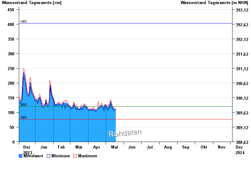
| Date | Mean value [cm] | Maximum [cm] | Minimum [cm] |
|---|---|---|---|
| 21.05.2024 | 114 | 118 | 112 |
| 20.05.2024 | 113 | 123 | 107 |
| 19.05.2024 | 116 | 120 | 111 |
| 18.05.2024 | 113 | 120 | 110 |
| 17.05.2024 | 111 | 114 | 109 |
| 16.05.2024 | 111 | 115 | 105 |
| 15.05.2024 | 112 | 118 | 106 |
© Bayerisches Landesamt für Umwelt 2024