
- Start >
- Rivers >
- Waterlevel >
- Untere Donau >
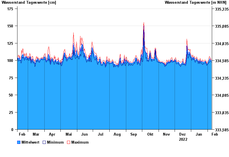
- Landau >
- Chart of year

Chart of year Landau / Isar
Waterlevel from 09.02.2022 to 08.02.2023
- 04.06.2013 Wasserstand: 495 cm
- 24.05.1999 Wasserstand: 467 cm
- 25.08.2005 Wasserstand: 462 cm
- 04.06.2010 Wasserstand: 383 cm
- 08.06.1995 Wasserstand: 345 cm
| Date | Mean value [cm] | Maximum [cm] | Minimum [cm] |
|---|---|---|---|
| 08.02.2023 | 100 | 102 | 97 |
| 07.02.2023 | 100 | 101 | 99 |
| 06.02.2023 | 100 | 103 | 99 |
| 05.02.2023 | 103 | 105 | 99 |
| 04.02.2023 | 101 | 106 | 97 |
| 03.02.2023 | 100 | 103 | 97 |
| 02.02.2023 | 98 | 100 | 95 |
© Bayerisches Landesamt für Umwelt 2024