
- Start >
- Rivers >
- Waterlevel >
- Untere Donau >
- Kothmaißling >
- Chart of year

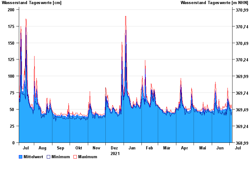
Chart of year Kothmaißling / Chamb
Waterlevel from 06.07.2021 to 05.07.2022
 Für diesen Pegel sind keine Meldestufen hinterlegt.
note
Beeinflussung durch Buhneneinbau unterhalb vom Pegel
| Date | Mean value [cm] | Maximum [cm] | Minimum [cm] |
|---|---|---|---|
| 05.07.2022 | 49 | 52 | 46 |
| 04.07.2022 | 50 | 57 | 41 |
| 03.07.2022 | 50 | 51 | 49 |
| 02.07.2022 | 52 | 56 | 48 |
| 01.07.2022 | 52 | 56 | 49 |
| 30.06.2022 | 59 | 63 | 54 |
| 29.06.2022 | 63 | 65 | 61 |
© Bayerisches Landesamt für Umwelt 2024