
- Start >
- Rivers >
- Waterlevel >
- Untere Donau >
- Köfering >
- Chart of month

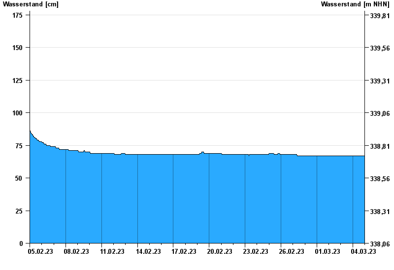
Chart of month Köfering / Pfatter
Waterlevel from 05.02.2023 to 04.03.2023
- 14.01.2011 Wasserstand: 196 cm
- 02.03.1987 Wasserstand: 186 cm
- 09.03.2006 Wasserstand: 181 cm
- 16.03.1988 Wasserstand: 180 cm
- 04.02.1980 Wasserstand: 178 cm
| Date | Waterlevel [cm] |
|---|---|
| 04.03.2023 23:45 | 67 |
| 04.03.2023 23:30 | 67 |
| 04.03.2023 23:15 | 67 |
| 04.03.2023 23:00 | 67 |
| 04.03.2023 22:45 | 67 |
| 04.03.2023 22:30 | 67 |
| 04.03.2023 22:15 | 67 |
© Bayerisches Landesamt für Umwelt 2024