
- Start >
- Rivers >
- Waterlevel >
- Untere Donau >
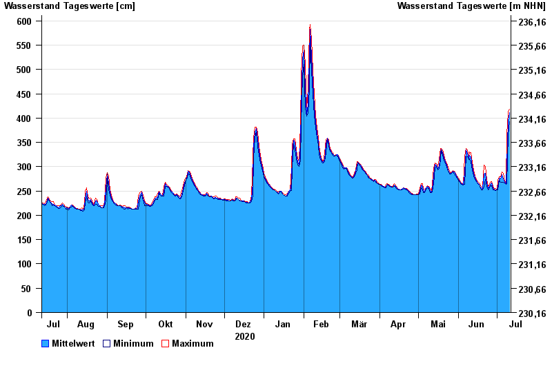
- Kemmern >
- Chart of year

Chart of year Kemmern / Main
Waterlevel from 12.07.2020 to 11.07.2021
- 04.01.2003 Wasserstand: 704 cm
- 25.12.1967 Wasserstand: 700 cm
- 07.01.1982 Wasserstand: 689 cm
- 15.01.2011 Wasserstand: 688 cm
- 29.01.2002 Wasserstand: 681 cm
| Date | Mean value [cm] | Maximum [cm] | Minimum [cm] |
|---|---|---|---|
| 11.07.2021 | 411 | 418 | 392 |
| 10.07.2021 | 393 | 412 | 366 |
| 09.07.2021 | 305 | 366 | 265 |
| 08.07.2021 | 265 | 267 | 264 |
| 07.07.2021 | 268 | 271 | 267 |
| 06.07.2021 | 275 | 287 | 268 |
| 05.07.2021 | 284 | 289 | 268 |
© Bayerisches Landesamt für Umwelt 2024