
- Start >
- Rivers >
- Waterlevel >
- Untere Donau >
- Kemmern >
- Chart of month

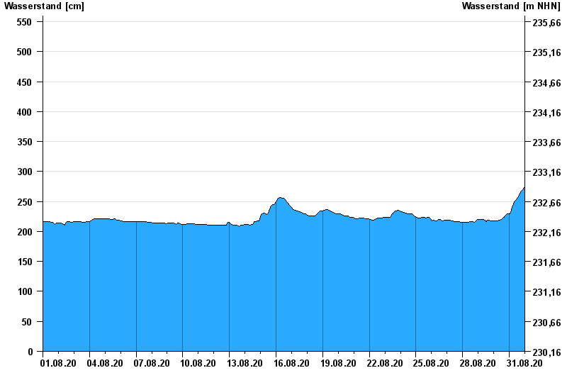
Chart of month Kemmern / Main
Waterlevel from 01.08.2020 to 31.08.2020
- 04.01.2003 Wasserstand: 704 cm
- 25.12.1967 Wasserstand: 700 cm
- 07.01.1982 Wasserstand: 689 cm
- 15.01.2011 Wasserstand: 688 cm
- 29.01.2002 Wasserstand: 681 cm
| Date | Waterlevel [cm] |
|---|---|
| 01.09.2020 00:45 | 276 |
| 01.09.2020 00:30 | 276 |
| 01.09.2020 00:15 | 275 |
| 01.09.2020 00:00 | 275 |
| 31.08.2020 23:45 | 274 |
| 31.08.2020 23:30 | 273 |
| 31.08.2020 23:15 | 273 |
© Bayerisches Landesamt für Umwelt 2024