
- Start >
- Rivers >
- Waterlevel >
- Untere Donau >
- Kalteneck >
- Chart of month

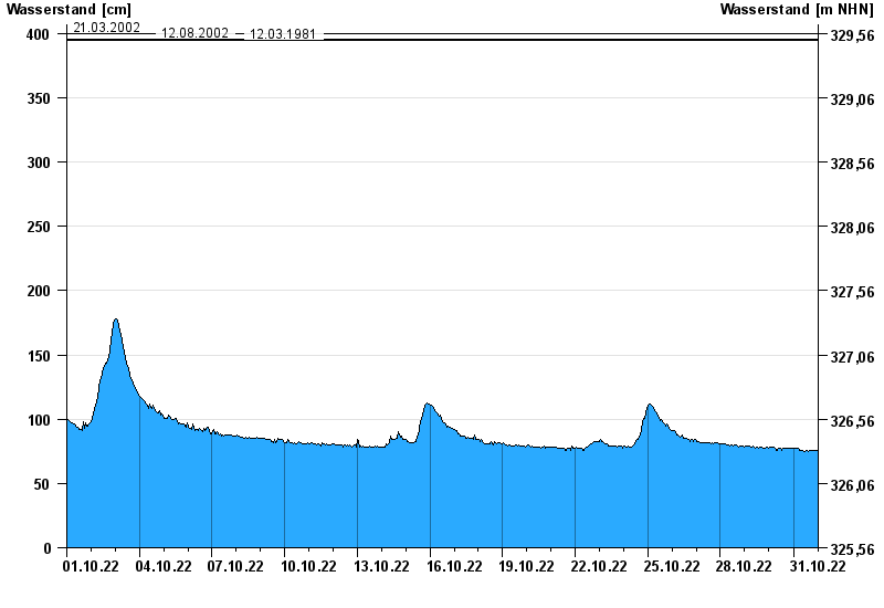
Chart of month Kalteneck / Ilz
Waterlevel from 01.10.2022 to 31.10.2022
- 21.12.1993 Wasserstand: 477 cm
- 16.03.2019 Wasserstand: 439 cm
- 21.03.2002 Wasserstand: 400 cm
- 12.08.2002 Wasserstand: 396 cm
- 12.03.1981 Wasserstand: 395 cm
| Date | Waterlevel [cm] |
|---|---|
| 31.10.2022 23:45 | 76 |
| 31.10.2022 23:30 | 76 |
| 31.10.2022 23:15 | 76 |
| 31.10.2022 23:00 | 76 |
| 31.10.2022 22:45 | 76 |
| 31.10.2022 22:30 | 76 |
| 31.10.2022 22:15 | 76 |
© Bayerisches Landesamt für Umwelt 2024