
- Start >
- Rivers >
- Waterlevel >
- Untere Donau >
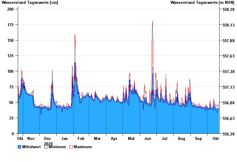
- Grafenau >
- Chart of year

Chart of year Grafenau / Kleine Ohe
Waterlevel from 23.10.2020 to 22.10.2021
- 12.08.2002 Wasserstand: 272 cm
- 21.12.1993 Wasserstand: 247 cm
- 21.03.2002 Wasserstand: 233 cm
- 09.08.2002 Wasserstand: 214 cm
- 19.12.1987 Wasserstand: 212 cm
| Date | Mean value [cm] | Maximum [cm] | Minimum [cm] |
|---|---|---|---|
| 22.10.2021 | 41 | 44 | 38 |
| 21.10.2021 | 40 | 47 | 38 |
| 20.10.2021 | 40 | 42 | 38 |
| 19.10.2021 | 40 | 43 | 34 |
| 18.10.2021 | 40 | 44 | 35 |
| 17.10.2021 | 41 | 47 | 36 |
| 16.10.2021 | 42 | 45 | 40 |
© Bayerisches Landesamt für Umwelt 2024