
- Start >
- Rivers >
- Waterlevel >
- Untere Donau >
- Grafenau >
- Current values

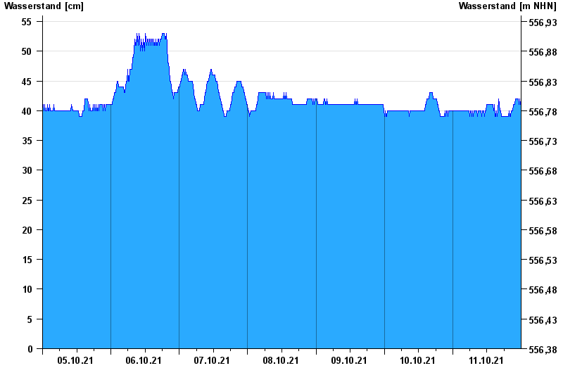
Current values Grafenau / Kleine Ohe
Waterlevel from 05.10.2021 to 11.10.2021
- Hochwassergefahrenfläche HQ100 270 cm
| Date | Waterlevel [cm] |
|---|---|
| 12.10.2021 00:45 | 41 |
| 12.10.2021 00:30 | 41 |
| 12.10.2021 00:15 | 41 |
| 12.10.2021 00:00 | 42 |
| 11.10.2021 23:45 | 41 |
| 11.10.2021 23:30 | 42 |
| 11.10.2021 23:15 | 41 |
© Bayerisches Landesamt für Umwelt 2024