
- Start >
- Rivers >
- Waterlevel >
- Untere Donau >
- Furth im Wald >
- Chart of month

Chart of month Furth im Wald / Chamb
Waterlevel from 01.05.2024 to 01.05.2024
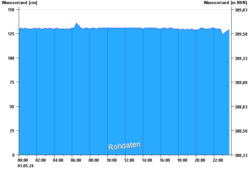
| Date | Waterlevel [cm] |
|---|---|
| 01.05.2024 23:30 | 128 |
| 01.05.2024 23:15 | 126 |
| 01.05.2024 23:00 | 124 |
| 01.05.2024 22:45 | 130 |
| 01.05.2024 22:30 | 130 |
| 01.05.2024 22:15 | 130 |
| 01.05.2024 22:00 | 131 |
© Bayerisches Landesamt für Umwelt 2024