
- Start >
- Rivers >
- Waterlevel >
- Untere Donau >
- Eschelbach >
- Chart of year

Chart of year Eschelbach / Inn
Waterlevel from 01.01.2024 to 31.12.2024
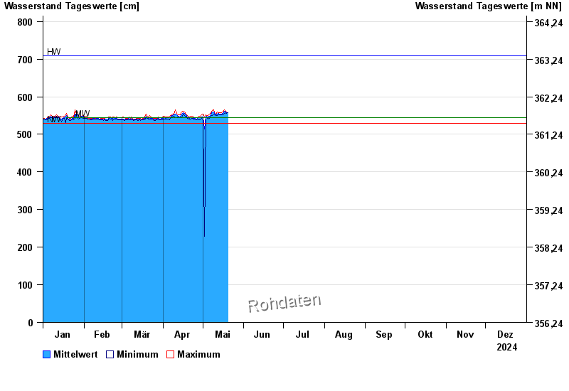
| Date | Mean value [cm] | Maximum [cm] | Minimum [cm] |
|---|---|---|---|
| 06.06.2024 | 568 | 569 | 567 |
| 05.06.2024 | 572 | 575 | 567 |
| 04.06.2024 | 598 | 627 | 569 |
| 03.06.2024 | 582 | 610 | 564 |
| 02.06.2024 | 570 | 581 | 564 |
| 01.06.2024 | 587 | 606 | 578 |
| 31.05.2024 | 580 | 593 | 571 |
© Bayerisches Landesamt für Umwelt 2024