
- Start >
- Rivers >
- Waterlevel >
- Untere Donau >
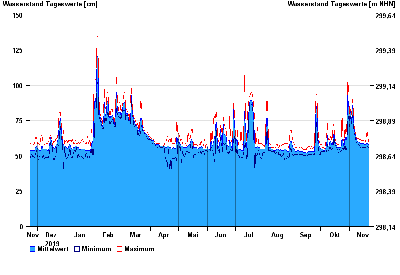
- Erlachleiten >
- Chart of year

Chart of year Erlachleiten / Erlau
Waterlevel from 23.11.2019 to 22.11.2020
- 25.06.2016 Wasserstand: 251 cm
- 16.03.2019 Wasserstand: 204 cm
- 20.06.2012 Wasserstand: 204 cm
- 06.07.2009 Wasserstand: 179 cm
- 14.01.2011 Wasserstand: 175 cm
| Date | Mean value [cm] | Maximum [cm] | Minimum [cm] |
|---|---|---|---|
| 22.11.2020 | 58 | 59 | 56 |
| 21.11.2020 | 58 | 63 | 56 |
| 20.11.2020 | 60 | 68 | 57 |
| 19.11.2020 | 59 | 65 | 57 |
| 18.11.2020 | 58 | 60 | 56 |
| 17.11.2020 | 58 | 60 | 56 |
| 16.11.2020 | 59 | 61 | 56 |
© Bayerisches Landesamt für Umwelt 2024