
- Start >
- Rivers >
- Waterlevel >
- Untere Donau >
- Erlachleiten >
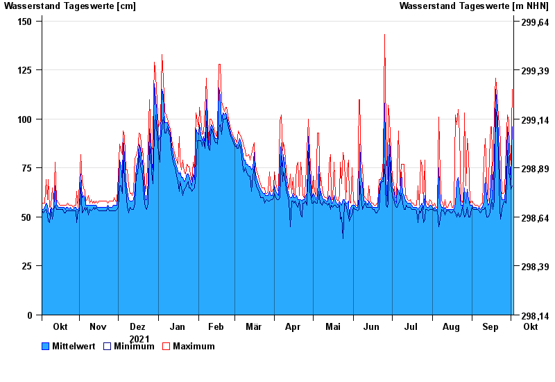
- Chart of year

Chart of year Erlachleiten / Erlau
Waterlevel from 03.10.2021 to 02.10.2022
| Date | Mean value [cm] | Maximum [cm] | Minimum [cm] |
|---|---|---|---|
| 02.10.2022 | 96 | 115 | 66 |
| 01.10.2022 | 69 | 77 | 64 |
| 30.09.2022 | 78 | 84 | 72 |
| 29.09.2022 | 85 | 99 | 72 |
| 28.09.2022 | 96 | 102 | 84 |
| 27.09.2022 | 69 | 87 | 57 |
| 26.09.2022 | 59 | 63 | 58 |
© Bayerisches Landesamt für Umwelt 2024