
- Start >
- Rivers >
- Waterlevel >
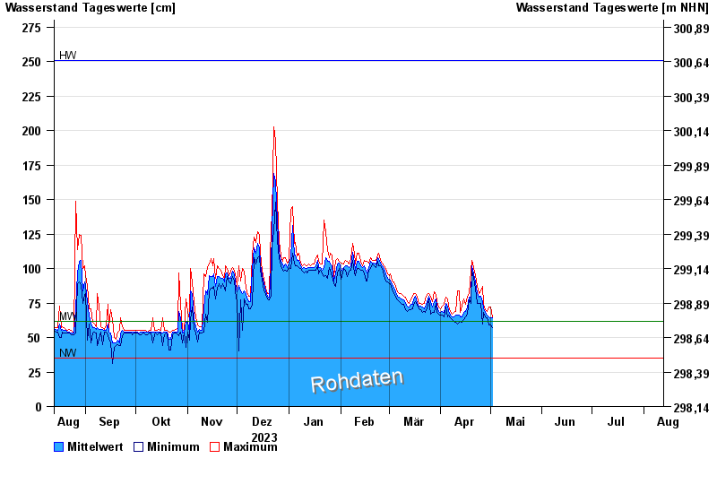
- Untere Donau >
- Erlachleiten >
- Chart of year

Chart of year Erlachleiten / Erlau
Waterlevel from 13.08.2023 to 12.08.2024
| Date | Mean value [cm] | Maximum [cm] | Minimum [cm] |
|---|---|---|---|
| 16.06.2024 | 73 | 96 | 68 |
| 15.06.2024 | 73 | 79 | 69 |
| 14.06.2024 | 83 | 90 | 74 |
| 13.06.2024 | 79 | 86 | 73 |
| 12.06.2024 | 87 | 98 | 78 |
| 11.06.2024 | 94 | 101 | 86 |
| 10.06.2024 | 99 | 107 | 94 |
© Bayerisches Landesamt für Umwelt 2024