
- Start >
- Rivers >
- Waterlevel >
- Untere Donau >
- Eggenfelden >
- Chart of year

Chart of year Eggenfelden / Mertseebach
Waterlevel from 15.06.2020 to 14.06.2021
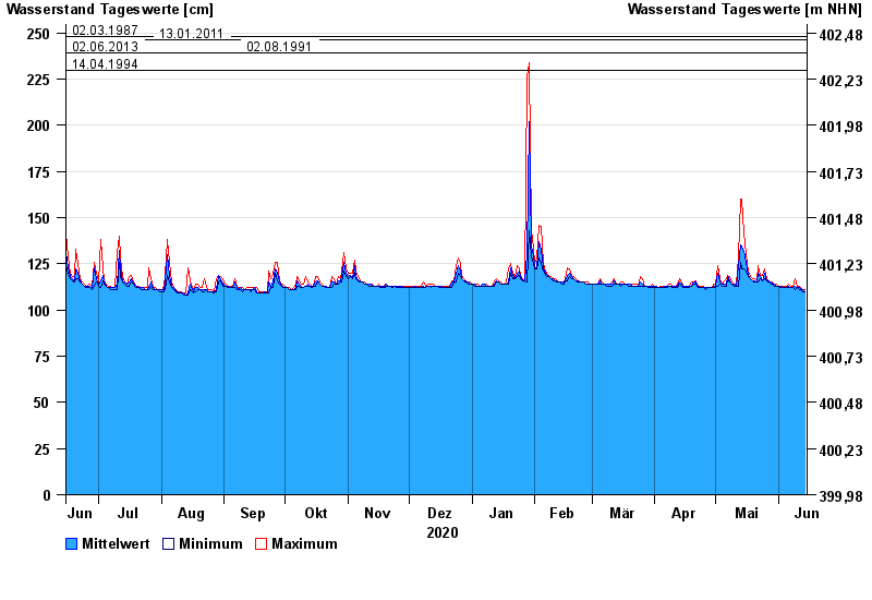
- 02.03.1987 Wasserstand: 248 cm
- 13.01.2011 Wasserstand: 246 cm
- 02.06.2013 Wasserstand: 239 cm
- 02.08.1991 Wasserstand: 239 cm
- 14.04.1994 Wasserstand: 230 cm
| Date | Mean value [cm] | Maximum [cm] | Minimum [cm] |
|---|---|---|---|
| 14.06.2021 | 110 | 111 | 110 |
| 13.06.2021 | 111 | 111 | 110 |
| 12.06.2021 | 111 | 112 | 111 |
| 11.06.2021 | 112 | 113 | 111 |
| 10.06.2021 | 112 | 113 | 112 |
| 09.06.2021 | 113 | 117 | 111 |
| 08.06.2021 | 112 | 113 | 112 |
© Bayerisches Landesamt für Umwelt 2024