
- Start >
- Rivers >
- Waterlevel >
- Untere Donau >
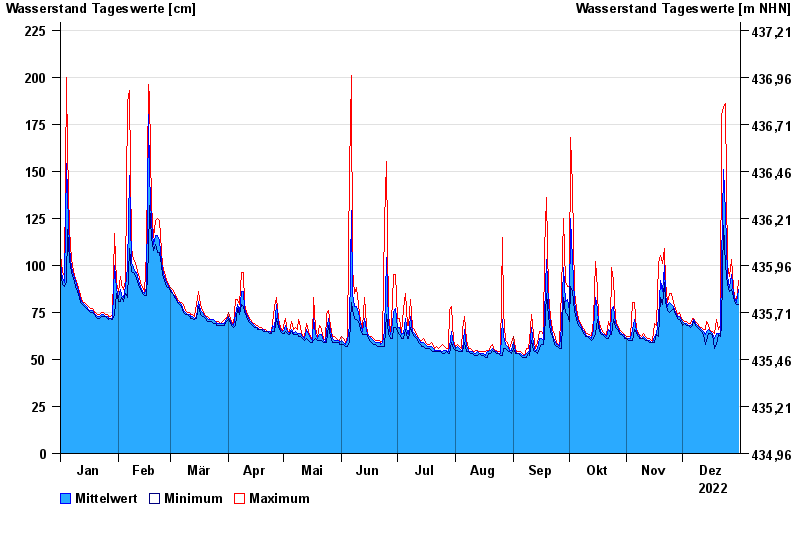
- Eberhardsreuth >
- Chart of year

Chart of year Eberhardsreuth / Mitternacher Ohe
Waterlevel from 01.01.2022 to 31.12.2022
- 05.12.1988 Wasserstand: 258 cm
- 08.07.2010 Wasserstand: 257 cm
- 23.02.1970 Wasserstand: 232 cm
- 01.11.1998 Wasserstand: 230 cm
- 08.12.1974 Wasserstand: 230 cm
| Date | Mean value [cm] | Maximum [cm] | Minimum [cm] |
|---|---|---|---|
| 31.12.2022 | 87 | 92 | 79 |
| 30.12.2022 | 80 | 81 | 79 |
| 29.12.2022 | 83 | 83 | 81 |
| 28.12.2022 | 85 | 88 | 83 |
| 27.12.2022 | 95 | 103 | 87 |
| 26.12.2022 | 88 | 94 | 86 |
| 25.12.2022 | 94 | 100 | 90 |
© Bayerisches Landesamt für Umwelt 2024