
- Start >
- Rivers >
- Waterlevel >
- Untere Donau >
- Donauwörth >
- Chart of month

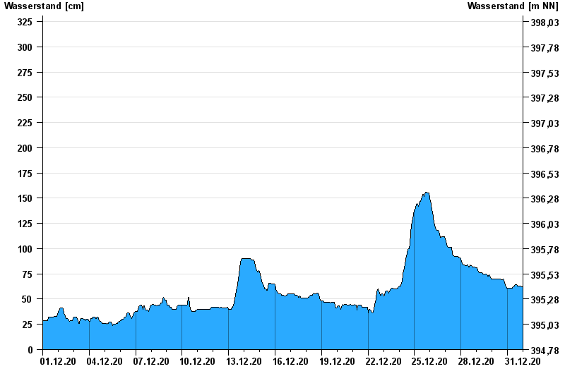
Chart of month Donauwörth / Donau
Waterlevel from 01.12.2020 to 31.12.2020
- 14.04.1994 Wasserstand: 577 cm
- 16.02.1990 Wasserstand: 553 cm
- 24.05.1999 Wasserstand: 552 cm
- 27.03.1988 Wasserstand: 544 cm
- 01.02.1982 Wasserstand: 543 cm
| Date | Waterlevel [cm] |
|---|---|
| 31.12.2020 23:45 | 61 |
| 31.12.2020 23:30 | 62 |
| 31.12.2020 23:15 | 62 |
| 31.12.2020 23:00 | 62 |
| 31.12.2020 22:45 | 62 |
| 31.12.2020 22:30 | 62 |
| 31.12.2020 22:15 | 62 |
© Bayerisches Landesamt für Umwelt 2024