
- Start >
- Rivers >
- Waterlevel >
- Untere Donau >
- Chamerau >
- Chart of year

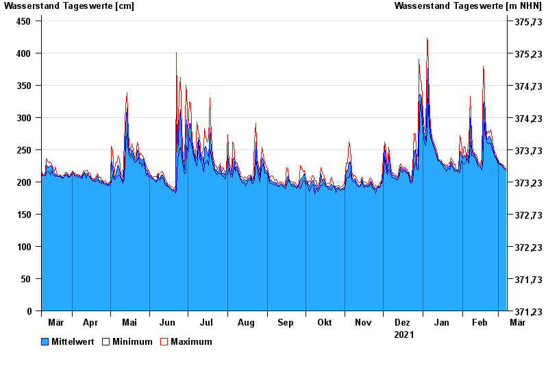
Chart of year Chamerau / Regen
Waterlevel from 08.03.2021 to 07.03.2022
- 13.08.2002 Wasserstand: 680 cm
- 21.12.1993 Wasserstand: 600 cm
- 22.07.1980 Wasserstand: 575 cm
- 01.11.1998 Wasserstand: 555 cm
- 21.03.2002 Wasserstand: 543 cm
| Date | Mean value [cm] | Maximum [cm] | Minimum [cm] |
|---|---|---|---|
| 07.03.2022 | 220 | 221 | 218 |
| 06.03.2022 | 221 | 223 | 220 |
| 05.03.2022 | 223 | 226 | 222 |
| 04.03.2022 | 226 | 226 | 225 |
| 03.03.2022 | 227 | 229 | 226 |
| 02.03.2022 | 229 | 229 | 228 |
| 01.03.2022 | 231 | 234 | 228 |
© Bayerisches Landesamt für Umwelt 2024