
- Start >
- Rivers >
- Waterlevel >
- Untere Donau >
- Birnbach >
- Chart of year

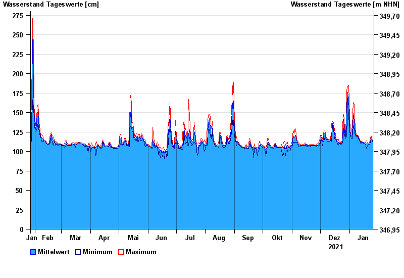
Chart of year Birnbach / Rott
Waterlevel from 27.01.2021 to 26.01.2022
- 01.06.2016 Wasserstand: 435 cm
- 02.08.1991 Wasserstand: 403 cm
- 03.06.2013 Wasserstand: 363 cm
- 20.02.1999 Wasserstand: 340 cm
- 13.01.2011 Wasserstand: 338 cm
| Date | Mean value [cm] | Maximum [cm] | Minimum [cm] |
|---|---|---|---|
| 26.01.2022 | 113 | 115 | 111 |
| 25.01.2022 | 115 | 116 | 115 |
| 24.01.2022 | 117 | 121 | 116 |
| 23.01.2022 | 112 | 116 | 111 |
| 22.01.2022 | 110 | 111 | 109 |
| 21.01.2022 | 110 | 110 | 109 |
| 20.01.2022 | 110 | 112 | 107 |
© Bayerisches Landesamt für Umwelt 2024