
- Start >
- Rivers >
- Waterlevel >
- Untere Donau >
- Birnbach >
- Chart of year

Chart of year Birnbach / Rott
Waterlevel from 29.03.2024 to 28.03.2025
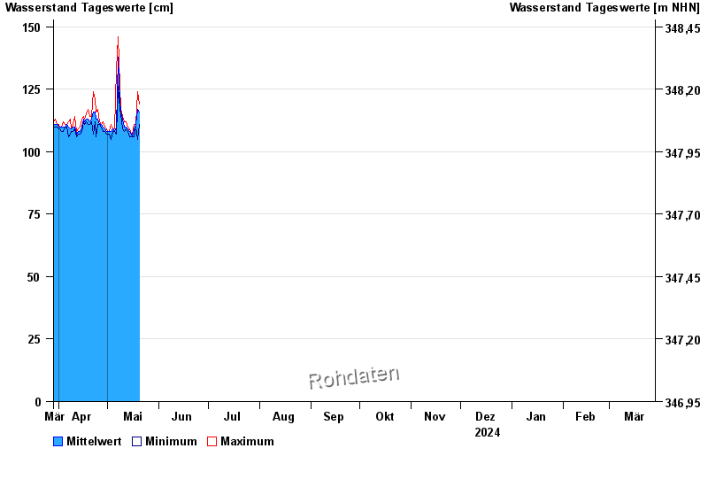
| Date | Mean value [cm] | Maximum [cm] | Minimum [cm] |
|---|---|---|---|
| 10.05.2024 | 114 | 114 | 112 |
| 09.05.2024 | 116 | 117 | 115 |
| 08.05.2024 | 120 | 126 | 117 |
| 07.05.2024 | 138 | 146 | 126 |
| 06.05.2024 | 110 | 133 | 107 |
| 05.05.2024 | 108 | 109 | 108 |
| 04.05.2024 | 109 | 109 | 108 |
© Bayerisches Landesamt für Umwelt 2024