
- Start >
- Rivers >
- Waterlevel >
- Untere Donau >
- Arzberg >
- Chart of month

Chart of month Arzberg / Röslau
Waterlevel from 02.01.2022 to 01.02.2022
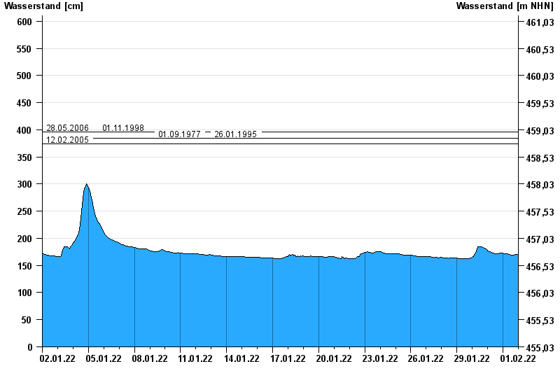
- 28.05.2006 Wasserstand: 396 cm
- 01.11.1998 Wasserstand: 396 cm
- 01.09.1977 Wasserstand: 385 cm
- 26.01.1995 Wasserstand: 384 cm
- 12.02.2005 Wasserstand: 374 cm
| Date | Waterlevel [cm] |
|---|---|
| 01.02.2022 23:45 | 170 |
| 01.02.2022 23:30 | 170 |
| 01.02.2022 23:15 | 170 |
| 01.02.2022 23:00 | 170 |
| 01.02.2022 22:45 | 170 |
| 01.02.2022 22:30 | 170 |
| 01.02.2022 22:15 | 170 |
© Bayerisches Landesamt für Umwelt 2024