
- Start >
- Rivers >
- Waterlevel >
- Untere Donau >
- Appolding >
- Chart of month

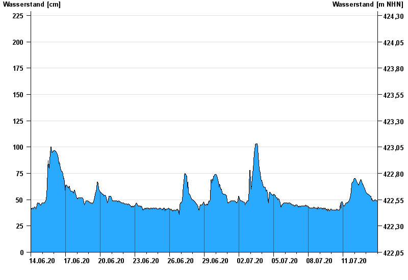
Chart of month Appolding / Strogen
Waterlevel from 14.06.2020 to 13.07.2020
- 09.06.1965 Wasserstand: 308 cm
- 01.06.1965 Wasserstand: 286 cm
- 03.06.2013 Wasserstand: 271 cm
- 02.08.1991 Wasserstand: 256 cm
- 15.02.1990 Wasserstand: 233 cm
| Date | Waterlevel [cm] |
|---|---|
| 14.07.2020 00:45 | 46 |
| 14.07.2020 00:30 | 47 |
| 14.07.2020 00:15 | 48 |
| 14.07.2020 00:00 | 48 |
| 13.07.2020 23:45 | 49 |
| 13.07.2020 23:30 | 49 |
| 13.07.2020 23:15 | 49 |
© Bayerisches Landesamt für Umwelt 2024