
- Start >
- Rivers >
- Waterlevel >
- Untere Donau >
- Appolding >
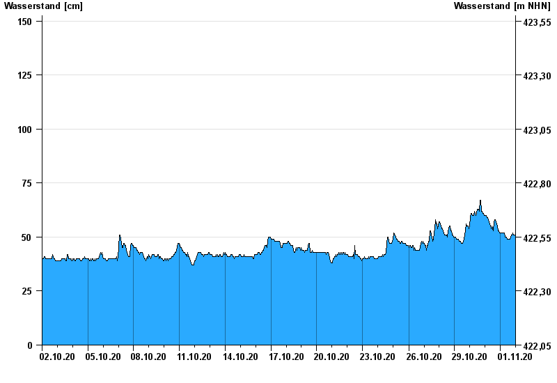
- Chart of month

Chart of month Appolding / Strogen
Waterlevel from 02.10.2020 to 01.11.2020
- 03.06.2013 Wasserstand: 271 cm
- 02.08.1991 Wasserstand: 256 cm
- 15.02.1990 Wasserstand: 233 cm
- 14.04.1994 Wasserstand: 214 cm
- 18.06.1979 Wasserstand: 213 cm
| Date | Waterlevel [cm] |
|---|---|
| 01.11.2020 23:45 | 51 |
| 01.11.2020 23:30 | 51 |
| 01.11.2020 23:15 | 51 |
| 01.11.2020 23:00 | 50 |
| 01.11.2020 22:45 | 50 |
| 01.11.2020 22:30 | 50 |
| 01.11.2020 22:15 | 50 |
© Bayerisches Landesamt für Umwelt 2024