
- Start >
- Rivers >
- Waterlevel >
- Naab - Regen >
- Windischeschenbach >
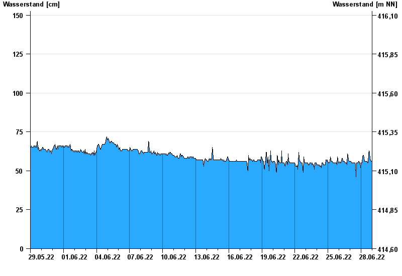
- Chart of month

Chart of month Windischeschenbach / Waldnaab
Waterlevel from 29.05.2022 to 28.06.2022
- 30.12.1986 Wasserstand: 328 cm
- 26.01.1995 Wasserstand: 326 cm
- 14.01.2011 Wasserstand: 309 cm
- 28.01.2002 Wasserstand: 299 cm
- 01.11.1998 Wasserstand: 294 cm
| Date | Waterlevel [cm] |
|---|---|
| 29.06.2022 00:45 | 56 |
| 29.06.2022 00:30 | 56 |
| 29.06.2022 00:15 | 56 |
| 29.06.2022 00:00 | 56 |
| 28.06.2022 23:45 | 56 |
| 28.06.2022 23:30 | 56 |
| 28.06.2022 23:15 | 56 |
© Bayerisches Landesamt für Umwelt 2024