
- Start >
- Rivers >
- Waterlevel >
- Naab - Regen >
- Unterköblitz >
- Chart of year

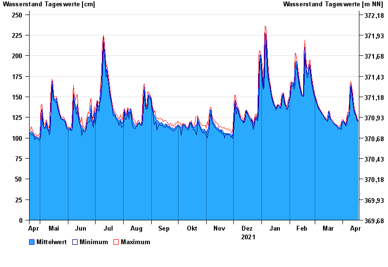
Chart of year Unterköblitz / Naab
Waterlevel from 19.04.2021 to 18.04.2022
- 15.01.2011 Wasserstand: 391 cm
- 27.01.1995 Wasserstand: 373 cm
- 03.01.2003 Wasserstand: 368 cm
- 26.03.1988 Wasserstand: 350 cm
- 07.02.1980 Wasserstand: 350 cm
| Date | Mean value [cm] | Maximum [cm] | Minimum [cm] |
|---|---|---|---|
| 18.04.2022 | 120 | 121 | 120 |
| 17.04.2022 | 122 | 124 | 121 |
| 16.04.2022 | 126 | 128 | 124 |
| 15.04.2022 | 129 | 130 | 128 |
| 14.04.2022 | 131 | 134 | 128 |
| 13.04.2022 | 136 | 141 | 134 |
| 12.04.2022 | 146 | 153 | 141 |
© Bayerisches Landesamt für Umwelt 2024