
- Start >
- Rivers >
- Waterlevel >
- Naab - Regen >
- Unterköblitz >
- Chart of year

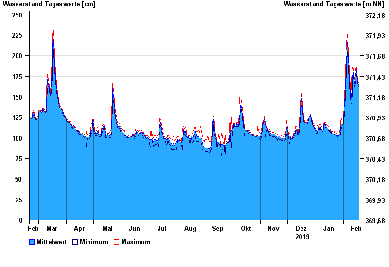
Chart of year Unterköblitz / Naab
Waterlevel from 19.02.2019 to 18.02.2020
- 15.01.2011 Wasserstand: 391 cm
- 27.01.1995 Wasserstand: 373 cm
- 03.01.2003 Wasserstand: 368 cm
- 26.03.1988 Wasserstand: 350 cm
- 07.02.1980 Wasserstand: 350 cm
| Date | Mean value [cm] | Maximum [cm] | Minimum [cm] |
|---|---|---|---|
| 18.02.2020 | 164 | 165 | 161 |
| 17.02.2020 | 166 | 170 | 163 |
| 16.02.2020 | 175 | 178 | 170 |
| 15.02.2020 | 183 | 186 | 178 |
| 14.02.2020 | 178 | 185 | 167 |
| 13.02.2020 | 166 | 171 | 162 |
| 12.02.2020 | 173 | 179 | 170 |
© Bayerisches Landesamt für Umwelt 2024