
- Start >
- Rivers >
- Waterlevel >
- Naab - Regen >
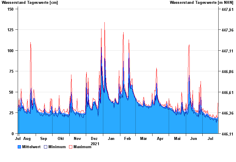
- Teisnach >
- Chart of year

Chart of year Teisnach / Teisnach
Waterlevel from 30.07.2021 to 29.07.2022
- 03.12.2007 Wasserstand: 233 cm
- 01.03.2008 Wasserstand: 216 cm
- 12.02.2005 Wasserstand: 207 cm
- 12.09.2008 Wasserstand: 201 cm
- 13.01.2011 Wasserstand: 190 cm
| Date | Mean value [cm] | Maximum [cm] | Minimum [cm] |
|---|---|---|---|
| 29.07.2022 | 20 | 37 | 15 |
| 28.07.2022 | 18 | 19 | 17 |
| 27.07.2022 | 18 | 20 | 17 |
| 26.07.2022 | 18 | 22 | 13 |
| 25.07.2022 | 18 | 19 | 17 |
| 24.07.2022 | 19 | 20 | 17 |
| 23.07.2022 | 18 | 19 | 17 |
© Bayerisches Landesamt für Umwelt 2024