
- Start >
- Rivers >
- Waterlevel >
- Naab - Regen >
- Schmidmühlen >
- Chart of year

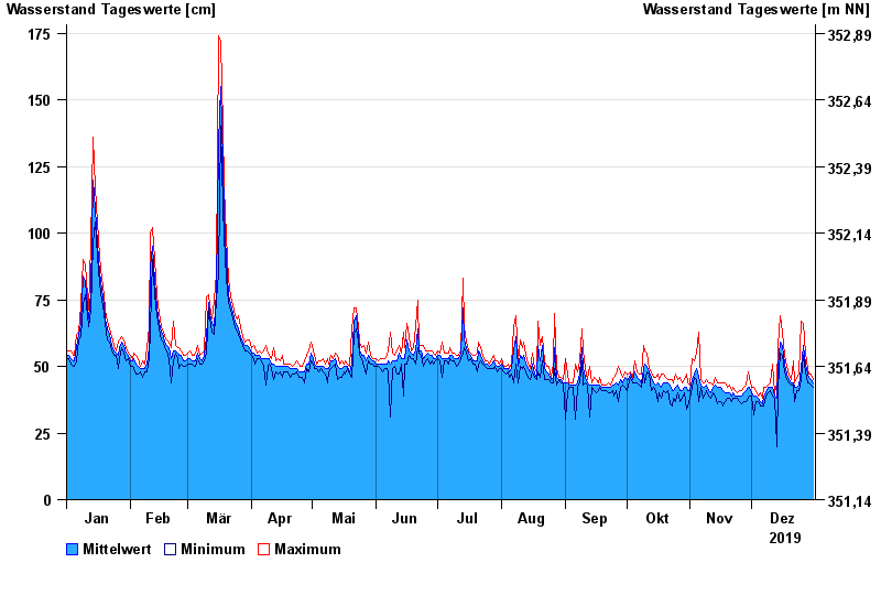
Chart of year Schmidmühlen / Vils
Waterlevel from 01.01.2019 to 31.12.2019
- 02.07.1987 Wasserstand: 294 cm
- 21.12.1993 Wasserstand: 293 cm
- 26.01.1995 Wasserstand: 275 cm
- 03.01.2003 Wasserstand: 266 cm
- 24.02.1970 Wasserstand: 265 cm
| Date | Mean value [cm] | Maximum [cm] | Minimum [cm] |
|---|---|---|---|
| 31.12.2019 | 44 | 45 | 42 |
| 30.12.2019 | 45 | 47 | 43 |
| 29.12.2019 | 46 | 47 | 44 |
| 28.12.2019 | 47 | 49 | 44 |
| 27.12.2019 | 51 | 55 | 48 |
| 26.12.2019 | 58 | 66 | 54 |
| 25.12.2019 | 49 | 67 | 45 |
© Bayerisches Landesamt für Umwelt 2024