
- Start >
- Rivers >
- Waterlevel >
- Naab - Regen >
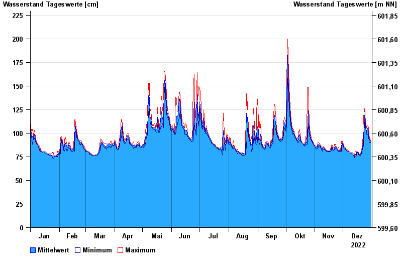
- Schlehdorf >
- Chart of year

Chart of year Schlehdorf / Loisach
Waterlevel from 01.01.2022 to 31.12.2022
- 22.05.1999 Wasserstand: 489 cm
- 23.08.2005 Wasserstand: 467 cm
- 03.06.2013 Wasserstand: 419 cm
- 05.08.2020 Wasserstand: 357 cm
- 19.07.2021 Wasserstand: 349 cm
| Date | Mean value [cm] | Maximum [cm] | Minimum [cm] |
|---|---|---|---|
| 31.12.2022 | 89 | 91 | 89 |
| 30.12.2022 | 92 | 93 | 91 |
| 29.12.2022 | 95 | 98 | 90 |
| 28.12.2022 | 101 | 106 | 98 |
| 27.12.2022 | 105 | 108 | 99 |
| 26.12.2022 | 101 | 106 | 99 |
| 25.12.2022 | 110 | 112 | 106 |
© Bayerisches Landesamt für Umwelt 2024