
- Start >
- Rivers >
- Waterlevel >
- Naab - Regen >
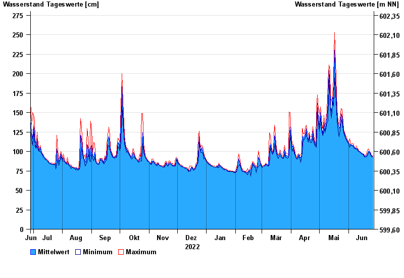
- Schlehdorf >
- Chart of year

Chart of year Schlehdorf / Loisach
Waterlevel from 28.06.2022 to 27.06.2023
- 22.05.1999 Wasserstand: 489 cm
- 23.08.2005 Wasserstand: 467 cm
- 03.06.2013 Wasserstand: 419 cm
- 15.06.1983 Wasserstand: 337 cm
- 03.06.2010 Wasserstand: 334 cm
| Date | Mean value [cm] | Maximum [cm] | Minimum [cm] |
|---|---|---|---|
| 27.06.2023 | 93 | 94 | 93 |
| 26.06.2023 | 94 | 95 | 93 |
| 25.06.2023 | 96 | 96 | 94 |
| 24.06.2023 | 98 | 99 | 96 |
| 23.06.2023 | 100 | 100 | 99 |
| 22.06.2023 | 100 | 103 | 98 |
| 21.06.2023 | 97 | 101 | 94 |
© Bayerisches Landesamt für Umwelt 2024