
- Start >
- Rivers >
- Waterlevel >
- Naab - Regen >
- Schlehdorf >
- Current values

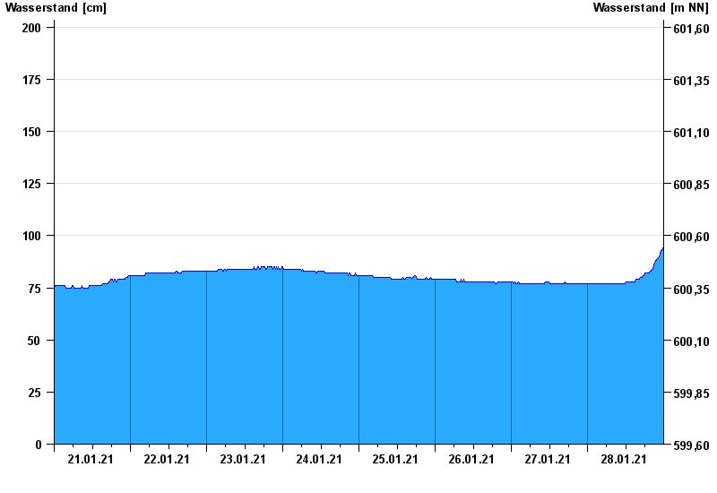
Current values Schlehdorf / Loisach
Waterlevel from 21.01.2021 to 28.01.2021
- 460 cm: Großweil-Unterau: Loisachdamm überflutet in Richtung Moos
| Date | Waterlevel [cm] |
|---|---|
| 28.01.2021 23:45 | 94 |
| 28.01.2021 23:30 | 93 |
| 28.01.2021 23:15 | 93 |
| 28.01.2021 23:00 | 92 |
| 28.01.2021 22:45 | 91 |
| 28.01.2021 22:30 | 90 |
| 28.01.2021 22:15 | 89 |
© Bayerisches Landesamt für Umwelt 2024