
- Start >
- Rivers >
- Waterlevel >
- Naab - Regen >
- Pulling >
- Chart of year

Chart of year Pulling / Regen
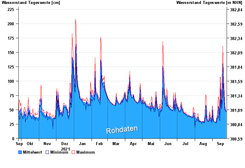
Waterlevel from 26.09.2021 to 25.09.2022
- 13.08.2002 Wasserstand: 437 cm
- 22.07.1980 Wasserstand: 374 cm
- 21.12.1993 Wasserstand: 358 cm
- 30.06.1966 Wasserstand: 340 cm
- 01.11.1998 Wasserstand: 327 cm
| Date | Mean value [cm] | Maximum [cm] | Minimum [cm] |
|---|---|---|---|
| 25.09.2022 | 47 | 48 | 46 |
| 24.09.2022 | 49 | 50 | 48 |
| 23.09.2022 | 54 | 57 | 50 |
| 22.09.2022 | 62 | 66 | 57 |
| 21.09.2022 | 77 | 91 | 66 |
| 20.09.2022 | 104 | 115 | 92 |
| 19.09.2022 | 130 | 161 | 97 |
© Bayerisches Landesamt für Umwelt 2024