
- Start >
- Rivers >
- Waterlevel >
- Naab - Regen >
- Plattling >
- Chart of year

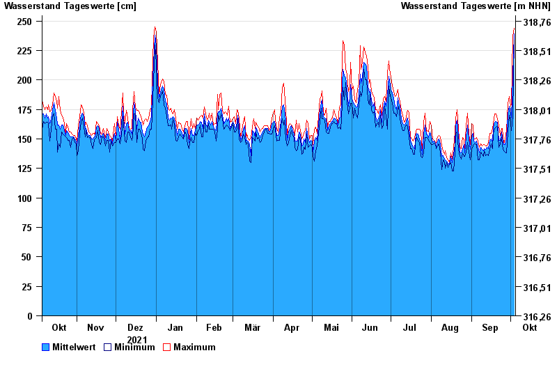
Chart of year Plattling / Isar
Waterlevel from 05.10.2021 to 04.10.2022
- 04.06.2013 Wasserstand: 400 cm
- 24.05.1999 Wasserstand: 378 cm
- 25.08.2005 Wasserstand: 374 cm
- 04.06.2010 Wasserstand: 349 cm
- 14.08.2002 Wasserstand: 335 cm
| Date | Mean value [cm] | Maximum [cm] | Minimum [cm] |
|---|---|---|---|
| 04.10.2022 | 239 | 244 | 234 |
| 03.10.2022 | 203 | 237 | 170 |
| 02.10.2022 | 168 | 179 | 157 |
| 01.10.2022 | 171 | 178 | 163 |
| 30.09.2022 | 178 | 186 | 170 |
| 29.09.2022 | 171 | 180 | 156 |
| 28.09.2022 | 150 | 157 | 138 |
© Bayerisches Landesamt für Umwelt 2024