
- Start >
- Rivers >
- Waterlevel >
- Naab - Regen >
- Plattling >
- Chart of year

Chart of year Plattling / Isar
Waterlevel from 05.10.2023 to 04.10.2024
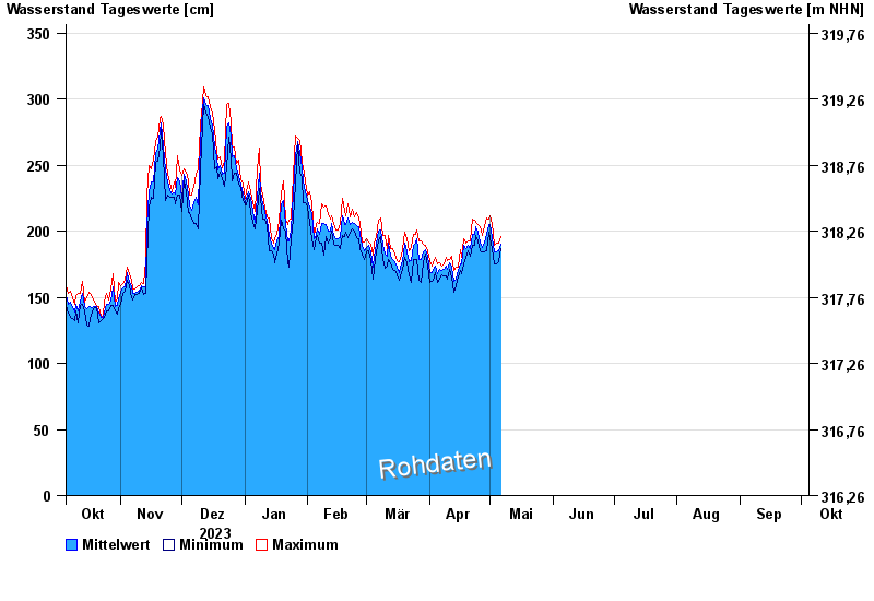
| Date | Mean value [cm] | Maximum [cm] | Minimum [cm] |
|---|---|---|---|
| 16.06.2024 | 243 | 250 | 234 |
| 15.06.2024 | 252 | 257 | 247 |
| 14.06.2024 | 258 | 263 | 250 |
| 13.06.2024 | 262 | 270 | 251 |
| 12.06.2024 | 279 | 290 | 267 |
| 11.06.2024 | 301 | 305 | 282 |
| 10.06.2024 | 297 | 304 | 290 |
© Bayerisches Landesamt für Umwelt 2024