
- Start >
- Rivers >
- Waterlevel >
- Naab - Regen >
- Plattling >
- Chart of year

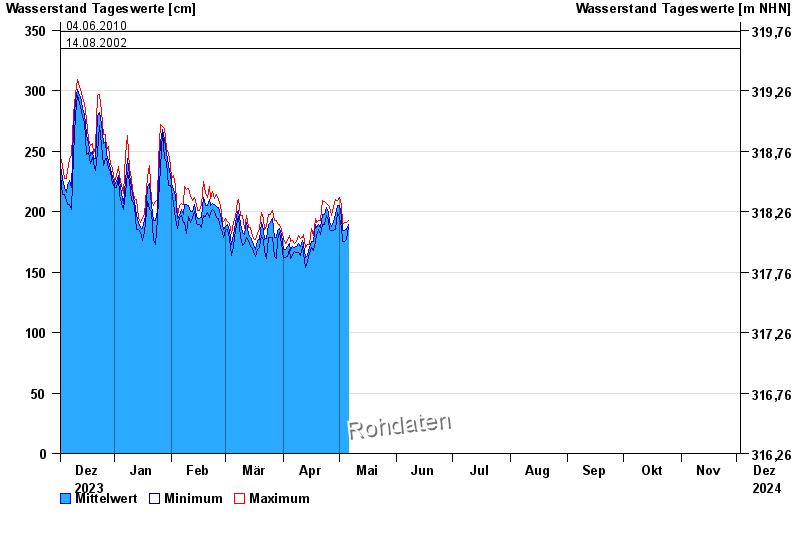
Chart of year Plattling / Isar
Waterlevel from 03.12.2023 to 02.12.2024
- 04.06.2013 Wasserstand: 400 cm
- 24.05.1999 Wasserstand: 378 cm
- 25.08.2005 Wasserstand: 374 cm
- 04.06.2010 Wasserstand: 349 cm
- 14.08.2002 Wasserstand: 335 cm
| Date | Mean value [cm] | Maximum [cm] | Minimum [cm] |
|---|---|---|---|
| 06.05.2024 | 191 | 196 | 187 |
| 05.05.2024 | 185 | 191 | 177 |
| 04.05.2024 | 184 | 191 | 175 |
| 03.05.2024 | 184 | 189 | 175 |
| 02.05.2024 | 195 | 206 | 187 |
| 01.05.2024 | 205 | 212 | 195 |
| 30.04.2024 | 205 | 209 | 199 |
© Bayerisches Landesamt für Umwelt 2024