
- Start >
- Rivers >
- Waterlevel >
- Naab - Regen >
- Plattling >
- Chart of year

Chart of year Plattling / Isar
Waterlevel from 07.12.2023 to 06.12.2024
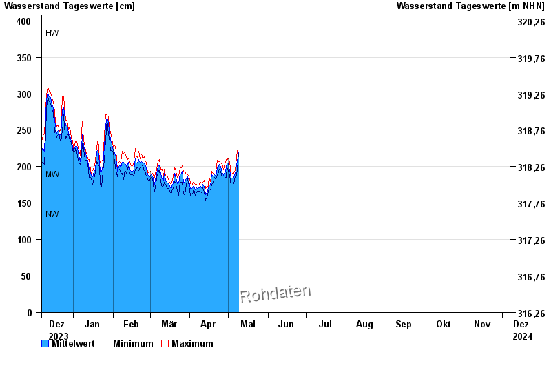
| Date | Mean value [cm] | Maximum [cm] | Minimum [cm] |
|---|---|---|---|
| 08.05.2024 | 200 | 206 | 196 |
| 07.05.2024 | 196 | 202 | 184 |
| 06.05.2024 | 191 | 196 | 187 |
| 05.05.2024 | 185 | 191 | 177 |
| 04.05.2024 | 184 | 191 | 175 |
| 03.05.2024 | 184 | 189 | 175 |
| 02.05.2024 | 195 | 206 | 187 |
© Bayerisches Landesamt für Umwelt 2024