
- Start >
- Rivers >
- Waterlevel >
- Naab - Regen >
- Pfrentsch >
- Chart of year

Chart of year Pfrentsch / Pfreimd
Waterlevel from 29.03.2024 to 28.03.2025
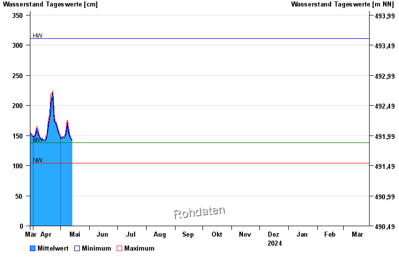
| Date | Mean value [cm] | Maximum [cm] | Minimum [cm] |
|---|---|---|---|
| 28.04.2024 | 159 | 161 | 158 |
| 27.04.2024 | 164 | 168 | 161 |
| 26.04.2024 | 171 | 173 | 168 |
| 25.04.2024 | 171 | 174 | 170 |
| 24.04.2024 | 180 | 188 | 174 |
| 23.04.2024 | 200 | 213 | 188 |
| 22.04.2024 | 221 | 224 | 213 |
© Bayerisches Landesamt für Umwelt 2024