
- Start >
- Rivers >
- Waterlevel >
- Naab - Regen >
- Michelfeld >
- Chart of month

Chart of month Michelfeld / Pegnitz
Waterlevel from 20.04.2024 to 19.05.2024
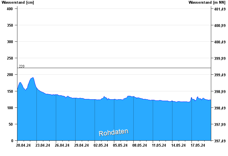
- 220 cm: Michelfeld: Überflutung der Straße am Pegel
| Date | Waterlevel [cm] |
|---|---|
| 02.05.2024 03:30 | 125 |
| 02.05.2024 03:15 | 125 |
| 02.05.2024 03:00 | 125 |
| 02.05.2024 02:45 | 125 |
| 02.05.2024 02:30 | 125 |
| 02.05.2024 02:15 | 125 |
| 02.05.2024 02:00 | 125 |
© Bayerisches Landesamt für Umwelt 2024