
- Start >
- Rivers >
- Waterlevel >
- Naab - Regen >
- Hammerles >
- Chart of year

Chart of year Hammerles / Schweinnaab
Waterlevel from 12.07.2020 to 11.07.2021
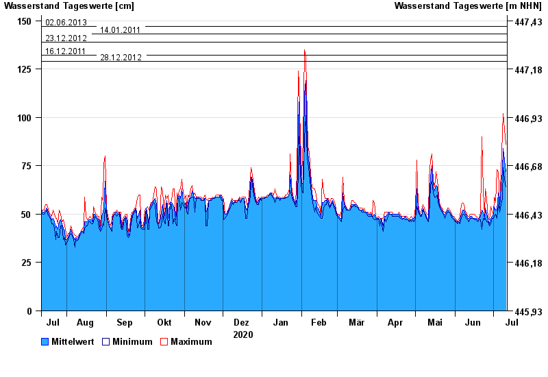
- 02.06.2013 Wasserstand: 147 cm
- 14.01.2011 Wasserstand: 143 cm
- 23.12.2012 Wasserstand: 139 cm
- 16.12.2011 Wasserstand: 132 cm
- 28.12.2012 Wasserstand: 129 cm
| Date | Mean value [cm] | Maximum [cm] | Minimum [cm] |
|---|---|---|---|
| 11.07.2021 | 72 | 86 | 64 |
| 10.07.2021 | 78 | 94 | 68 |
| 09.07.2021 | 84 | 102 | 74 |
| 08.07.2021 | 72 | 92 | 58 |
| 07.07.2021 | 65 | 72 | 55 |
| 06.07.2021 | 53 | 55 | 51 |
| 05.07.2021 | 61 | 72 | 55 |
© Bayerisches Landesamt für Umwelt 2024