
- Start >
- Rivers >
- Waterlevel >
- Naab - Regen >
- Gogl-Mühle >
- Chart of month

Chart of month Gogl-Mühle / Chamb
Waterlevel from 01.04.2024 to 29.04.2024
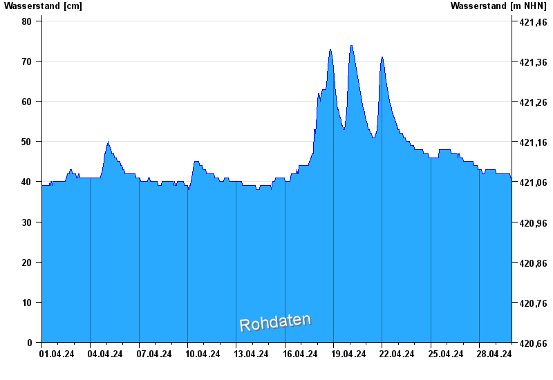
- Hochwassergefahrenfläche HQ100 170 cm
| Date | Waterlevel [cm] |
|---|---|
| 29.04.2024 23:15 | 41 |
| 29.04.2024 23:00 | 41 |
| 29.04.2024 22:45 | 41 |
| 29.04.2024 22:30 | 41 |
| 29.04.2024 22:15 | 41 |
| 29.04.2024 22:00 | 41 |
| 29.04.2024 21:45 | 41 |
© Bayerisches Landesamt für Umwelt 2024