
- Start >
- Rivers >
- Waterlevel >
- Naab - Regen >
- Fronhof >
- Chart of year

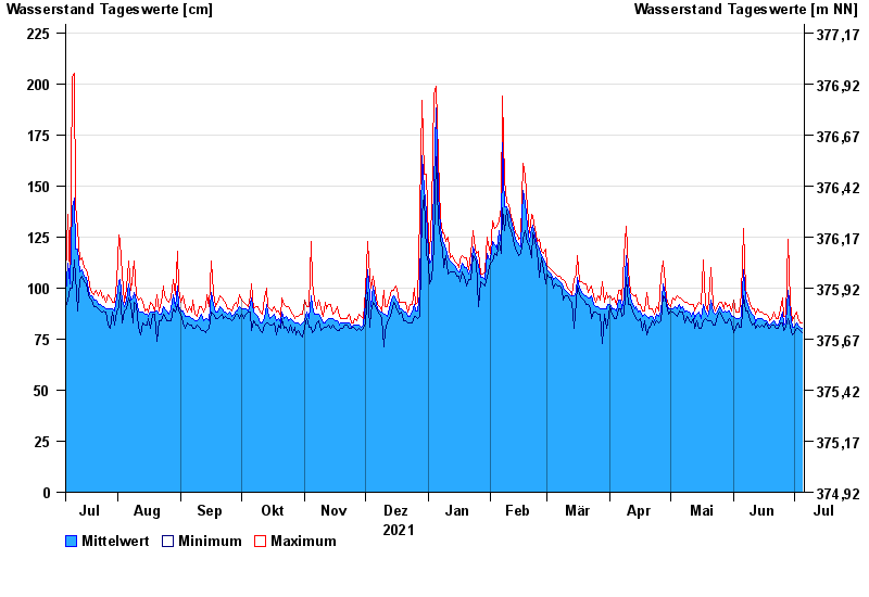
Chart of year Fronhof / Murach
Waterlevel from 06.07.2021 to 05.07.2022
- 03.06.2013 Wasserstand: 312 cm
- 26.01.1995 Wasserstand: 304 cm
- 13.02.2005 Wasserstand: 301 cm
- 21.12.1993 Wasserstand: 301 cm
- 13.01.2011 Wasserstand: 297 cm
| Date | Mean value [cm] | Maximum [cm] | Minimum [cm] |
|---|---|---|---|
| 05.07.2022 | 80 | 83 | 78 |
| 04.07.2022 | 81 | 83 | 79 |
| 03.07.2022 | 82 | 85 | 80 |
| 02.07.2022 | 83 | 88 | 80 |
| 01.07.2022 | 81 | 86 | 78 |
| 30.06.2022 | 81 | 84 | 77 |
| 29.06.2022 | 88 | 93 | 81 |
© Bayerisches Landesamt für Umwelt 2024