
- Start >
- Rivers >
- Waterlevel >
- Naab - Regen >
- Fronhof >
- Chart of year

Chart of year Fronhof / Murach
Waterlevel from 09.12.2025 to 08.12.2026
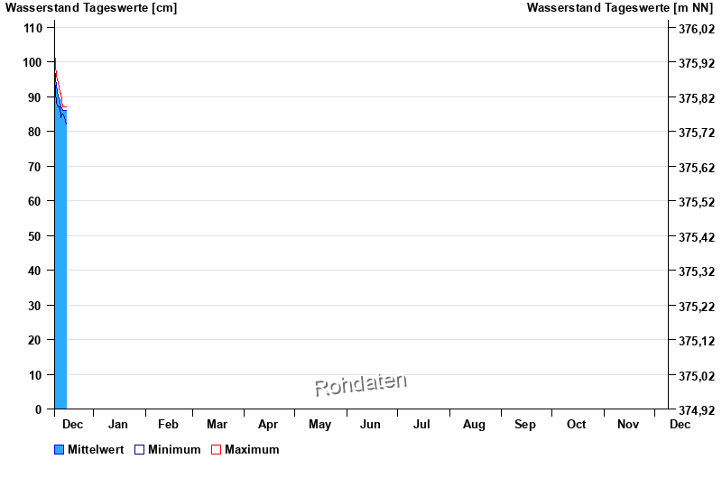
| Date | Mean value [cm] | Maximum [cm] | Minimum [cm] |
|---|---|---|---|
| 16.12.2025 | 87 | 87 | 85 |
| 15.12.2025 | 86 | 87 | 84 |
| 14.12.2025 | 86 | 87 | 85 |
| 13.12.2025 | 87 | 91 | 84 |
| 12.12.2025 | 89 | 91 | 87 |
| 11.12.2025 | 90 | 94 | 87 |
| 10.12.2025 | 93 | 96 | 88 |
© Bayerisches Landesamt für Umwelt 2025