
- Start >
- Rivers >
- Waterlevel >
- Naab - Regen >
- Erbendorf >
- Chart of year

Chart of year Erbendorf / Fichtelnaab
Waterlevel from 01.01.2023 to 31.12.2023
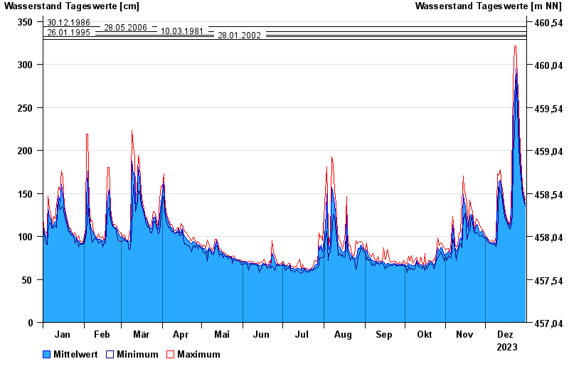
- 30.12.1986 Wasserstand: 344 cm
- 28.05.2006 Wasserstand: 338 cm
- 10.03.1981 Wasserstand: 334 cm
- 26.01.1995 Wasserstand: 332 cm
- 28.01.2002 Wasserstand: 329 cm
| Date | Mean value [cm] | Maximum [cm] | Minimum [cm] |
|---|---|---|---|
| 31.12.2023 | 138 | 142 | 135 |
| 30.12.2023 | 146 | 149 | 142 |
| 29.12.2023 | 154 | 160 | 148 |
| 28.12.2023 | 167 | 176 | 160 |
| 27.12.2023 | 187 | 203 | 176 |
| 26.12.2023 | 225 | 249 | 203 |
| 25.12.2023 | 273 | 287 | 249 |
© Bayerisches Landesamt für Umwelt 2024